
Sugar Hill Reservoir from the north bank.
This week, as part of my staycation explorations of Vermont, I returned to the Moosamaloo natural area in Ripton and Goshen. My destination, Sugar Hill Reservoir, came from the Middlebury Trailrunner, though I took a different route. From the Widow’s Clearing parking lot, I followed the trail east to the intersection that leads toward the Water Tower loops, but headed south along the Catamount cross-country ski trail. One of the great things about mixed use trails like this one is they’re less demanding than, say, the steep side of Mount Mansfield. I can plod along and enjoy the scenery without necessarily having to scramble up boulders and ledges.
As the trail went on, I kept wondering if I’d missed a turn, or mistaken the correct time to keep right for an access path leading to the Ripton-Goshen road. After sticking with the path, though, I could see a break in the treeline at the top of a slope. Approaching, I realized the slope was made of a wall of shaped blocks, with a deep layer of turf and vegetation over it. This had to be the reservoir.
Emerging from the trees, I found I was on the north side of the reservoir, of what might be the main embankment. There was a tower with antenna and instruments further along the embankment. Down on the shore, someone busied themselves building small cairns, scattered around an informal little fire pit.
Apart from one or two planes flying by — though nowhere I could spot them in the sky — the sounds of Sugar Hill came entirely from the wind and wildlife. As time passed, I kept thinking I heard voices on the wind, which I guess was my brain trying to fill in the chatter it’s used to hearing around town. The relative absence of background noise became a little unnerving. At one point on the walk back, my blood ran cold when I thought I heard a penny whistle tootle in the woods behind me. The tootler never revealed themselves, so I moved on with purpose.
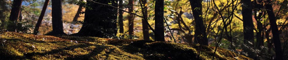
For the walk back, I took the Catamount trail to the first access point, and switched back to the forest road. The dry road was more appealing than the marshy sections of trail I’d already passed through. And I got that nice picture of the mountain through the trees in the gallery below. Somewhere in the center lower third of that picture are apple trees growing wild.
-
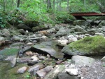
- A bridge crossing on the Catamount Trail.
-
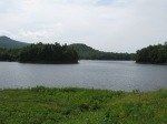
- Sugar Hill Reservoir from the north bank.
-
- Sugar Hill Reservoir from the north bank.
-

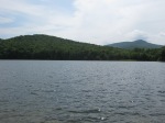
- View from the forest road to the west.

